![]()
| Home | People | Research | Publications | Demos |
| News | Jobs |
Prospective
Students |
About | Internal |

| Static Map and Chart | |
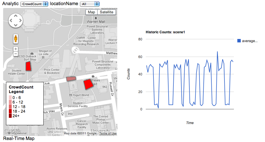
|
Description: Static-image version of dynamic map. Left column displays a count map. Right side displays historic trends. Colored polygons indicate current counts, averaged over classes, for that specific geospatial area. |
|
|
![]()
©
SVCL